

TIRZ 17 Memorial City Area Detention Basin
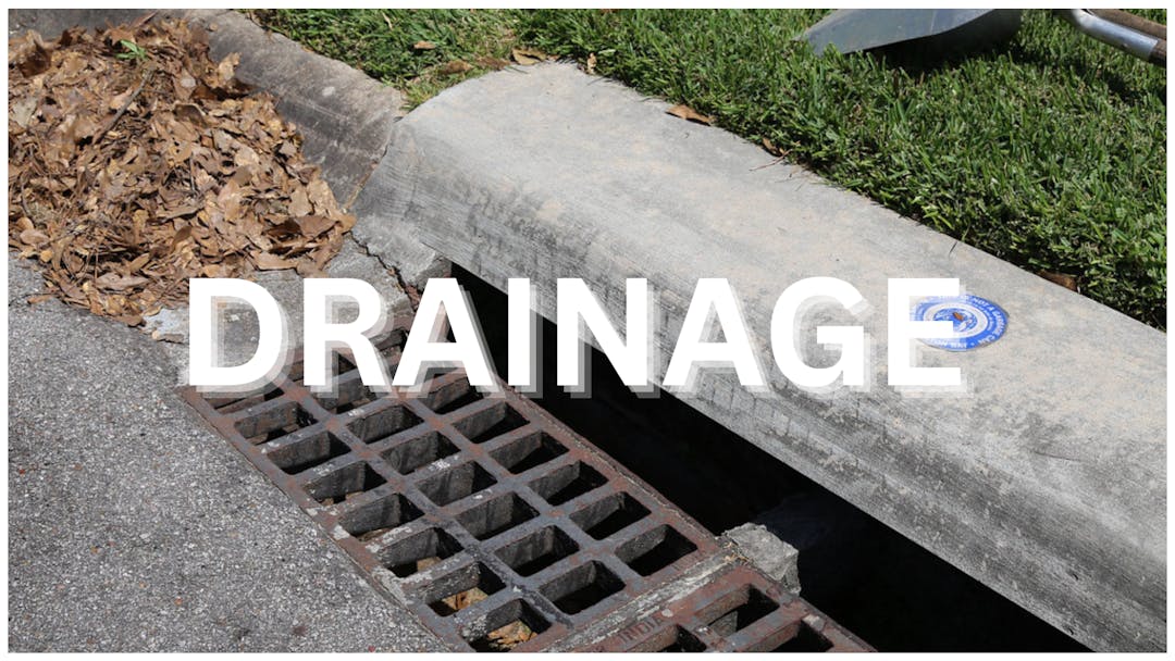
Project Overview
Council District: G
Project Number: M-430296-0017
Estimated Budget: $75,000,000
Start: Spring 2027
Completion: Summer 2029
Project Impact Area

Community Feedback
Have questions or feedback about this project? Email us at engage@houstontx.gov or call 311.
Project Overview
Council District: G
Project Number: M-430296-0017
Estimated Budget: $75,000,000
Start: Spring 2027
Completion: Summer 2029
Project Impact Area
Community Feedback
Have questions or feedback about this project? Email us at engage@houstontx.gov or call 311.
What’s your question for the project team?
-
Share Please describe in detail the proposed plan for Vindon Drive. This seems like a terrible disruption to the school, SBMSA and the surrounding neighborhoods. on Facebook Share Please describe in detail the proposed plan for Vindon Drive. This seems like a terrible disruption to the school, SBMSA and the surrounding neighborhoods. on X (formerly Twitter) Share Please describe in detail the proposed plan for Vindon Drive. This seems like a terrible disruption to the school, SBMSA and the surrounding neighborhoods. on Linkedin Email Please describe in detail the proposed plan for Vindon Drive. This seems like a terrible disruption to the school, SBMSA and the surrounding neighborhoods. link
Please describe in detail the proposed plan for Vindon Drive. This seems like a terrible disruption to the school, SBMSA and the surrounding neighborhoods.
Jennifer asked 25 days agoReady...Set...ENGAGE!
Thank you for engaging with the TIRZ 17 Memorial City Area Detention Basin Project and for sharing your concern about impacts to the school, SBMSA, and surrounding neighborhoods.Work on Vindon Drive will be limited. The detention basin’s 24-inch outfall pipe will be placed between the back of the roadway curb and the edge of the City right-of-way, rather than in the travel lanes. Temporary traffic control plans were developed as part of the construction package with the goal of minimizing disruption to everyone who uses the roadway.
The City project team has also coordinated with Spring Branch Memorial Middle School staff to plan the construction work in a way that minimizes disruption to the campus. We will continue to share updates as construction approaches.
-
Share Will the proposed storm sewer line in Barryknoll Lane and Kingsride Lane be tied into the existing storm sewer lines in Plantation Road, Frostwood Drive and Benignus Road that serves the neighborhoods off of those streets? Please provide a link to the latest full set of plans showing all of the inlets and existing neighborhood storm drain tie-ins to the new storm line from Memorial City Mall to Memorial Middle School. on Facebook Share Will the proposed storm sewer line in Barryknoll Lane and Kingsride Lane be tied into the existing storm sewer lines in Plantation Road, Frostwood Drive and Benignus Road that serves the neighborhoods off of those streets? Please provide a link to the latest full set of plans showing all of the inlets and existing neighborhood storm drain tie-ins to the new storm line from Memorial City Mall to Memorial Middle School. on X (formerly Twitter) Share Will the proposed storm sewer line in Barryknoll Lane and Kingsride Lane be tied into the existing storm sewer lines in Plantation Road, Frostwood Drive and Benignus Road that serves the neighborhoods off of those streets? Please provide a link to the latest full set of plans showing all of the inlets and existing neighborhood storm drain tie-ins to the new storm line from Memorial City Mall to Memorial Middle School. on Linkedin Email Will the proposed storm sewer line in Barryknoll Lane and Kingsride Lane be tied into the existing storm sewer lines in Plantation Road, Frostwood Drive and Benignus Road that serves the neighborhoods off of those streets? Please provide a link to the latest full set of plans showing all of the inlets and existing neighborhood storm drain tie-ins to the new storm line from Memorial City Mall to Memorial Middle School. link
Will the proposed storm sewer line in Barryknoll Lane and Kingsride Lane be tied into the existing storm sewer lines in Plantation Road, Frostwood Drive and Benignus Road that serves the neighborhoods off of those streets? Please provide a link to the latest full set of plans showing all of the inlets and existing neighborhood storm drain tie-ins to the new storm line from Memorial City Mall to Memorial Middle School.
asked 25 days agoReady...Set...ENGAGE!
Thank you for engaging with the TIRZ 17 Memorial City Area Detention Basin Project.Yes, the existing connections will be maintained. The main storm line on Kingsride Lane currently connects with the storm lines on Frostwood Drive and Benignus Road, and the new main storm line will keep those connections. Likewise, the existing Barryknoll Lane storm line connects with Plantation Road, and that connection will remain in place.
The project is currently out for bid, and the full set of plans is available here: https://www.beaconbid.com/solicitations/city-of-houston/20436028-2670-4337-a033-e55af36e1bc8/tirz-memorial-city-area-detention-basin
-
Share This project only seems to serve Metro National and it's interest. Why are the taxpayers, school district and surrounding neighborhoods being harmed to the benefit of a for-profit private company? on Facebook Share This project only seems to serve Metro National and it's interest. Why are the taxpayers, school district and surrounding neighborhoods being harmed to the benefit of a for-profit private company? on X (formerly Twitter) Share This project only seems to serve Metro National and it's interest. Why are the taxpayers, school district and surrounding neighborhoods being harmed to the benefit of a for-profit private company? on Linkedin Email This project only seems to serve Metro National and it's interest. Why are the taxpayers, school district and surrounding neighborhoods being harmed to the benefit of a for-profit private company? link
This project only seems to serve Metro National and it's interest. Why are the taxpayers, school district and surrounding neighborhoods being harmed to the benefit of a for-profit private company?
PBK asked about 1 month agoReady...Set...ENGAGE!
Thank you for engaging with the TIRZ 17 Memorial City Area Detention Basin Project and for sharing your concerns.The project’s greatest benefit is to the residential neighborhoods south of the Memorial City commercial area. It is designed to intercept and detain stormwater that currently contributes to street and structural flooding in those neighborhoods. Most of the intercepted flow comes from Harris County Flood Control District (HCFCD) Ditch W151-00-00, along with local storm drainage and surface inlets along the new box culvert path that carries water to the proposed underground detention basin at Memorial Middle School.
The Tax Increment Reinvestment Zone (TIRZ 17), which is primarily funded through growth in commercial property values, has been and will remain a primary funding partner for the project.
For more details on the project’s benefits, please see the presentation from the January 7, 2026 public meeting (Slide 15 in particular): https://www.engagehouston.org/30960/widgets/110605/documents/77088
You can also view information on Ditch W151-00-00 at https://www.harriscountyfws.org by selecting “Channels.
-
Share Does the design for Kingsride Lane, from Gessner Road west to the dead end at Memorial Middle School, fit entirely within the existing public ROW? Or are any permanent or temporary easements, or any property acquisition, needed on private lots along Kingsride? on Facebook Share Does the design for Kingsride Lane, from Gessner Road west to the dead end at Memorial Middle School, fit entirely within the existing public ROW? Or are any permanent or temporary easements, or any property acquisition, needed on private lots along Kingsride? on X (formerly Twitter) Share Does the design for Kingsride Lane, from Gessner Road west to the dead end at Memorial Middle School, fit entirely within the existing public ROW? Or are any permanent or temporary easements, or any property acquisition, needed on private lots along Kingsride? on Linkedin Email Does the design for Kingsride Lane, from Gessner Road west to the dead end at Memorial Middle School, fit entirely within the existing public ROW? Or are any permanent or temporary easements, or any property acquisition, needed on private lots along Kingsride? link
Does the design for Kingsride Lane, from Gessner Road west to the dead end at Memorial Middle School, fit entirely within the existing public ROW? Or are any permanent or temporary easements, or any property acquisition, needed on private lots along Kingsride?
Kingsride Resident asked about 2 months agoReady...Set...ENGAGE!
Dear Kingsride Resident,
Thank you for engaging with us regarding the TIRZ 17 Memorial City Area Detention Basin Project.
The design for Kingsride Lane, from Gessner Road west to the dead end at Memorial Middle School, fits entirely within the existing public right of way. No permanent or temporary easements and no property acquisition are needed from private lots along this stretch.
If you have any other questions about the project, please reply through EngageHouston.org or visit the project page for the latest updates.
Sincerely,
Engagement Team, Houston Public Works -
Share The timeframe of this project is slated for 3 years. Will there be phases of demolition and construction? Will Kingsride Lane (from SBMSA fields to Frostwood) be under construction the entire 3 years or for just a portion of this timeframe? on Facebook Share The timeframe of this project is slated for 3 years. Will there be phases of demolition and construction? Will Kingsride Lane (from SBMSA fields to Frostwood) be under construction the entire 3 years or for just a portion of this timeframe? on X (formerly Twitter) Share The timeframe of this project is slated for 3 years. Will there be phases of demolition and construction? Will Kingsride Lane (from SBMSA fields to Frostwood) be under construction the entire 3 years or for just a portion of this timeframe? on Linkedin Email The timeframe of this project is slated for 3 years. Will there be phases of demolition and construction? Will Kingsride Lane (from SBMSA fields to Frostwood) be under construction the entire 3 years or for just a portion of this timeframe? link
The timeframe of this project is slated for 3 years. Will there be phases of demolition and construction? Will Kingsride Lane (from SBMSA fields to Frostwood) be under construction the entire 3 years or for just a portion of this timeframe?
AMej asked 3 months agoReady...Set...ENGAGE!
Dear AMej,
Thank you for your question. Here's what we can share:
Construction on this project is anticipated to begin in Spring 2027 and be completed by Summer 2029.
The project will be built in phases rather than all at once. Kingsride Lane, from the SBMSA fields to Frostwood, is just one part of a larger phased construction plan, so it won't be under construction for the entire project duration. Within each phase, roadway work is done in two steps, reconstructing half the road at a time, so traffic can keep flowing on the other side while work is underway.
Based on the current phasing plan, we expect construction along this specific stretch of Kingsride Lane to last roughly 9 to 10 months, and possibly less, since this section is expected to be simpler to build than segments further east.
We'll share more detailed timing at a Virtual Community Meeting, which will be scheduled closer to the start of construction. We'll continue to keep the community informed as the project progresses.
-
Share We have street flooding on Pinerock, just south and east of this project. Will this project lessen or potentially eliminate the street flooding? on Facebook Share We have street flooding on Pinerock, just south and east of this project. Will this project lessen or potentially eliminate the street flooding? on X (formerly Twitter) Share We have street flooding on Pinerock, just south and east of this project. Will this project lessen or potentially eliminate the street flooding? on Linkedin Email We have street flooding on Pinerock, just south and east of this project. Will this project lessen or potentially eliminate the street flooding? link
We have street flooding on Pinerock, just south and east of this project. Will this project lessen or potentially eliminate the street flooding?
Kristie asked 5 months agoReady...Set...ENGAGE!
Thank you for engaging with us.
Yes, the project is expected to reduce street flooding on Pinerock Lane south of the project area. Flooding reductions are anticipated throughout the area, with greater benefits west of Gessner Road than east of Gessner Road.
To view the projected flooding improvements, please visit the Engage Houston project page and select Documents & Downloads. Then open the TIRZ 17 Memorial City Area Detention Basin Presentation and review Slide 15, which shows the proposed 100-year flooding reduction map.
Please note that while the project is designed to significantly reduce flooding, it is not expected to completely eliminate street flooding in this area.
– Engage Houston Team
-
Share Is there a plan that will show the proximity in feet of the detention basin to the property line? How would the city plan to mitigate any potential damages from the excavation and construction of the basin on to adjacent properties along Vindon? on Facebook Share Is there a plan that will show the proximity in feet of the detention basin to the property line? How would the city plan to mitigate any potential damages from the excavation and construction of the basin on to adjacent properties along Vindon? on X (formerly Twitter) Share Is there a plan that will show the proximity in feet of the detention basin to the property line? How would the city plan to mitigate any potential damages from the excavation and construction of the basin on to adjacent properties along Vindon? on Linkedin Email Is there a plan that will show the proximity in feet of the detention basin to the property line? How would the city plan to mitigate any potential damages from the excavation and construction of the basin on to adjacent properties along Vindon? link
Is there a plan that will show the proximity in feet of the detention basin to the property line? How would the city plan to mitigate any potential damages from the excavation and construction of the basin on to adjacent properties along Vindon?
Donna asked 6 months agoReady...Set...ENGAGE!
The Engage Houston project website includes the public presentation from January 7, 2026. Slide 18 illustrates the proposed basin footprint in relation to the shaded green school parcel property lines; however, the exhibit is not shown to scale and does not include dimensions in feet.
According to the approved 100% design plans, the minimum distance between the subsurface detention basin structure and the adjacent property lines is approximately:
- 20 feet from the western property line
- 20 feet from the northern property line
- 15 feet from the eastern property line
To help mitigate and monitor potential impacts to adjacent properties during construction, the City plans to conduct pre-construction surveys that include comprehensive visual documentation of nearby properties and existing conditions. In addition, construction monitoring of perimeter surface elevations will be performed throughout basin excavation and construction activities.
For roadway-related construction, pre-construction photographs will also be taken, and City inspectors will be on-site to monitor construction activities and address any concerns that may arise during the project.
Engage Houston Team
-
Share Hello. What is the updated cost for this project and who is funding? Also, can you please attach rendering/ diagram of basin which has been provided to the City? Where will basin be constructed in relation to residential property lines/ Attingham Drive/ SBMSA fields? Thank you! on Facebook Share Hello. What is the updated cost for this project and who is funding? Also, can you please attach rendering/ diagram of basin which has been provided to the City? Where will basin be constructed in relation to residential property lines/ Attingham Drive/ SBMSA fields? Thank you! on X (formerly Twitter) Share Hello. What is the updated cost for this project and who is funding? Also, can you please attach rendering/ diagram of basin which has been provided to the City? Where will basin be constructed in relation to residential property lines/ Attingham Drive/ SBMSA fields? Thank you! on Linkedin Email Hello. What is the updated cost for this project and who is funding? Also, can you please attach rendering/ diagram of basin which has been provided to the City? Where will basin be constructed in relation to residential property lines/ Attingham Drive/ SBMSA fields? Thank you! link
Hello. What is the updated cost for this project and who is funding? Also, can you please attach rendering/ diagram of basin which has been provided to the City? Where will basin be constructed in relation to residential property lines/ Attingham Drive/ SBMSA fields? Thank you!
Amej asked 6 months agoReady...Set...ENGAGE!
Thank you for reaching out with your questions regarding the project.
Project cost and funding information can be found in the public meeting presentation available on the project Engage Houston webpage:
TIRZ 17 Memorial Area Detention Basin Project Page
(Located on the right side of the webpage under “Documents & Downloads.”)
The project is funded through a grant from the Federal Emergency Management Agency (FEMA), along with local sponsors including TIRZ 17 Memorial City Redevelopment Authority and the Harris County Flood Control District (HCFCD). Harris County Precinct 3 has also been supportive of the project, including HCFCD funding participation.
The underground detention basin will be constructed on the Memorial Middle School property, east of Attingham Drive, in the northern portion of the property beneath the current location of the SBMSA baseball fields.
Additionally, a project location map and basin drawing/rendering are included in the public meeting presentation available on the Engage Houston project webpage linked above.
Regards,
The Engage Houston Team
-
Share Hello, can you please provide exact plans about widening streets in the memorial meadows areas. The plans and rendering do not show exact impact on the street. I would like to see exact plans on which streets will be widened and which parts of the streets. Can you specifically share for Kingsride, benignus, vindon? on Facebook Share Hello, can you please provide exact plans about widening streets in the memorial meadows areas. The plans and rendering do not show exact impact on the street. I would like to see exact plans on which streets will be widened and which parts of the streets. Can you specifically share for Kingsride, benignus, vindon? on X (formerly Twitter) Share Hello, can you please provide exact plans about widening streets in the memorial meadows areas. The plans and rendering do not show exact impact on the street. I would like to see exact plans on which streets will be widened and which parts of the streets. Can you specifically share for Kingsride, benignus, vindon? on Linkedin Email Hello, can you please provide exact plans about widening streets in the memorial meadows areas. The plans and rendering do not show exact impact on the street. I would like to see exact plans on which streets will be widened and which parts of the streets. Can you specifically share for Kingsride, benignus, vindon? link
Hello, can you please provide exact plans about widening streets in the memorial meadows areas. The plans and rendering do not show exact impact on the street. I would like to see exact plans on which streets will be widened and which parts of the streets. Can you specifically share for Kingsride, benignus, vindon?
Stephane asked 7 months agoReady...Set...ENGAGE!
The project will reconstruct the following streets as described: full width of Barryknoll Lane from west of Betina to Gessner Road; only the far east side of the northbound lane on Gessner Road from Barryknoll Lane to Kingsride Lane and a roughly 60' full width of Gessner in line with the eastbound lanes of Kingsride Lane; full width of Kingsride Lane from Gessner Road west to the dead end at Memorial Middle School. Then, in regards to street widening (roadway pavement): Barryknoll Lane two west bound lanes will be widened from 10 ft to 11 ft each while the two eastbound lanes remain the same 10 ft width; Gessner Road lanes will not be widened; Kingsride Lane will not be widened. Also, the project will have limited work (typically outside of the curb line) along Vindon Drive from the Memorial Middle School to Hallie Drive.
- The Engage Houston Team
-
Share Has a subsurface detention project of this size been completed in Houston? If so, can you please detail where? on Facebook Share Has a subsurface detention project of this size been completed in Houston? If so, can you please detail where? on X (formerly Twitter) Share Has a subsurface detention project of this size been completed in Houston? If so, can you please detail where? on Linkedin Email Has a subsurface detention project of this size been completed in Houston? If so, can you please detail where? link
Has a subsurface detention project of this size been completed in Houston? If so, can you please detail where?
AMej asked 7 months agoReady...Set...ENGAGE!
Thank you for your question.
Subsurface detention basins have been constructed in Houston and throughout the surrounding region; however, we are not currently aware of any projects of this size that have been completed by Houston Public Works.
There is a similar, though smaller, reinforced concrete subsurface detention basin that was privately developed near Allen Parkway, east of Montrose Boulevard. While it differs in scale, it reflects the type of approach being used for this project.
We appreciate your interest and are happy to provide additional information as it becomes available.
The Engage Houston Team
-
Design
TIRZ 17 Memorial City Area Detention Basin is currently at this stage -
Construction
this is an upcoming stage for TIRZ 17 Memorial City Area Detention Basin -
Completion
this is an upcoming stage for TIRZ 17 Memorial City Area Detention Basin
Reduces neighborhood flooding in the Memorial area
The TIRZ 17 Memorial Area Detention Basin is designed to hold a large volume of stormwater during heavy rains, then slowly release it back into the system. That extra storage helps lower water levels in nearby storm sewers and channels, reducing the risk of homes, businesses, schools, and medical facilities flooding in and around Memorial City.Protects a major regional hub, not just one street
Memorial City is a dense corridor of hospitals, shopping, offices, and neighborhoods right along I-10. This detention basin is a regional project—engineered to take pressure off multiple drainage systems feeding into the area, not just fix one localized problem spot.Uses hard-won hazard mitigation dollars wisely
After Hurricane Harvey, FEMA hazard mitigation funds were awarded to only a handful of major Houston flood-reduction projects. The TIRZ 17 basin is one of them, meaning federal dollars are being leveraged with local TIRZ funds to deliver long-term protection that would have taken many more years to build otherwise.Builds long-term resilience into the drainage system
By pairing a large sub-surface detention basin with upstream conveyance improvements, this project helps the system handle more intense storms that are becoming more common in Houston—supporting safer streets, drier homes, and a stronger tax base for the long run.


Thank you for your contribution!
Help us reach out to more people in the community
Share this with family and friends