

Turkey Gully
Project Overview
Council District: C
Project Number: M-410291-0001
Estimated Budget: 16,990,000
Start: Fall 2026
Completion: Winter 2028
Project Impact Area

Community Feedback
Have questions or feedback about this project? Email us at engage@houstontx.gov or call 311.
Project Overview
Council District: C
Project Number: M-410291-0001
Estimated Budget: 16,990,000
Start: Fall 2026
Completion: Winter 2028
Project Impact Area
Community Feedback
Have questions or feedback about this project? Email us at engage@houstontx.gov or call 311.
Is there anything you want us to know?
-
Share Why aren't any comment from the last 2years? Why was there such a drastic change in the design away from MUTCD updates? on Facebook Share Why aren't any comment from the last 2years? Why was there such a drastic change in the design away from MUTCD updates? on X (formerly Twitter) Share Why aren't any comment from the last 2years? Why was there such a drastic change in the design away from MUTCD updates? on Linkedin Email Why aren't any comment from the last 2years? Why was there such a drastic change in the design away from MUTCD updates? link
Why aren't any comment from the last 2years? Why was there such a drastic change in the design away from MUTCD updates?
George asked 20 days agoReady...Set...ENGAGE!
Thank you for your continued engagement with the Turkey Gully Project. We truly appreciate your interest and patience.
We sincerely apologize for any confusion regarding the visibility of comments and project updates on the EngageHouston platform. We want to assure you that community input is valued and taken seriously throughout the life of this project.
To ensure you are aware of the most recent developments, we hosted a Virtual Community Meeting on February 19, 2026, where several key project updates were presented, including:
- The intersection at E TC Jester Boulevard, W 20th Street, and W 18th Street will be upgraded from a four-way stop to a fully signalized intersection. The roundabout alternative is no longer being considered.
- The proposed signalized intersection will include dedicated pedestrian signal phases and raised medians to improve safety and traffic operations at this location.
- Construction is currently anticipated to begin in Fall 2026, with completion expected in Winter 2028.
As the project continues to evolve, we are committed to keeping the EngageHouston project page updated with the latest information. If there are any additional changes, you will be able to find them reflected there.If you have any other questions or would like to discuss the project further, please do not hesitate to reach out. We are happy to help.
- Engage Houston Team
-
Share If this project opts to include storm drains and the associated road improvements, please consider extending the area north along Bevis an additional block to 610. This would improve traffic flows in & out of the neighborhood and the restraunts & bars on 20th. on Facebook Share If this project opts to include storm drains and the associated road improvements, please consider extending the area north along Bevis an additional block to 610. This would improve traffic flows in & out of the neighborhood and the restraunts & bars on 20th. on X (formerly Twitter) Share If this project opts to include storm drains and the associated road improvements, please consider extending the area north along Bevis an additional block to 610. This would improve traffic flows in & out of the neighborhood and the restraunts & bars on 20th. on Linkedin Email If this project opts to include storm drains and the associated road improvements, please consider extending the area north along Bevis an additional block to 610. This would improve traffic flows in & out of the neighborhood and the restraunts & bars on 20th. link
If this project opts to include storm drains and the associated road improvements, please consider extending the area north along Bevis an additional block to 610. This would improve traffic flows in & out of the neighborhood and the restraunts & bars on 20th.
David asked over 2 years agoHowdy Neighbor! Thank you for sharing your concern with us. We have shared it with the project team.
-
Share Super Neighborhood 14 would like to host HPW CIP & TOD presenting Turkey Gully plans. on Facebook Share Super Neighborhood 14 would like to host HPW CIP & TOD presenting Turkey Gully plans. on X (formerly Twitter) Share Super Neighborhood 14 would like to host HPW CIP & TOD presenting Turkey Gully plans. on Linkedin Email Super Neighborhood 14 would like to host HPW CIP & TOD presenting Turkey Gully plans. link
Super Neighborhood 14 would like to host HPW CIP & TOD presenting Turkey Gully plans.
George asked over 3 years agoWe have forwarded your request to the project team. Thank you.
-
Share W18th is a designated as a high access corridor for future but currently it is high injury network. Can the sidewalks in this project be greater than 6ft wide to allow different forms of non-vehicular traffic? ie bikes/pedestrians in a shared use path on Facebook Share W18th is a designated as a high access corridor for future but currently it is high injury network. Can the sidewalks in this project be greater than 6ft wide to allow different forms of non-vehicular traffic? ie bikes/pedestrians in a shared use path on X (formerly Twitter) Share W18th is a designated as a high access corridor for future but currently it is high injury network. Can the sidewalks in this project be greater than 6ft wide to allow different forms of non-vehicular traffic? ie bikes/pedestrians in a shared use path on Linkedin Email W18th is a designated as a high access corridor for future but currently it is high injury network. Can the sidewalks in this project be greater than 6ft wide to allow different forms of non-vehicular traffic? ie bikes/pedestrians in a shared use path link
W18th is a designated as a high access corridor for future but currently it is high injury network. Can the sidewalks in this project be greater than 6ft wide to allow different forms of non-vehicular traffic? ie bikes/pedestrians in a shared use path
George asked almost 3 years agoHowdy Neighbor! Your comments are noted. We noticed steep grade changes at the intersection of the existing parking lot east of Discount Tire. However, we will look into it during the design process. Thank you!
-
Share The Jan31 map showed a ditch (green line) extending along w20th street and cutting through E TC Jester. Is there an update that can show actual details of intersections? on Facebook Share The Jan31 map showed a ditch (green line) extending along w20th street and cutting through E TC Jester. Is there an update that can show actual details of intersections? on X (formerly Twitter) Share The Jan31 map showed a ditch (green line) extending along w20th street and cutting through E TC Jester. Is there an update that can show actual details of intersections? on Linkedin Email The Jan31 map showed a ditch (green line) extending along w20th street and cutting through E TC Jester. Is there an update that can show actual details of intersections? link
The Jan31 map showed a ditch (green line) extending along w20th street and cutting through E TC Jester. Is there an update that can show actual details of intersections?
George asked almost 3 years agoHowdy Neighbor! This project is currently in the design phase. Please stay tuned for all upcoming updates regarding this project. Thank you, and have a great day!
-
Share Can you share the detailed documents presented during Jan 31 and any more recent updates? They were provided to Dist C but this is not readily available to community seeking info. on Facebook Share Can you share the detailed documents presented during Jan 31 and any more recent updates? They were provided to Dist C but this is not readily available to community seeking info. on X (formerly Twitter) Share Can you share the detailed documents presented during Jan 31 and any more recent updates? They were provided to Dist C but this is not readily available to community seeking info. on Linkedin Email Can you share the detailed documents presented during Jan 31 and any more recent updates? They were provided to Dist C but this is not readily available to community seeking info. link
Can you share the detailed documents presented during Jan 31 and any more recent updates? They were provided to Dist C but this is not readily available to community seeking info.
George asked almost 3 years agoHowdy Neighbor! The requested documents presented on January 31, 2023, along with other documents, can be found at this link: https://www.engagehouston.org/turkey-gully-local-drainage-improvements-study. Thank you!
-
Share What will be the short term and long term impact on White Oak Bayou trail? How long will it be closed? will there be a detour? on Facebook Share What will be the short term and long term impact on White Oak Bayou trail? How long will it be closed? will there be a detour? on X (formerly Twitter) Share What will be the short term and long term impact on White Oak Bayou trail? How long will it be closed? will there be a detour? on Linkedin Email What will be the short term and long term impact on White Oak Bayou trail? How long will it be closed? will there be a detour? link
What will be the short term and long term impact on White Oak Bayou trail? How long will it be closed? will there be a detour?
George asked almost 3 years agoHowdy Neighbor! This project is currently in the design phase. However, the White Oak Bayou trail can be opened during construction, the detailed plan will be discussed soon. Please stay tuned for all upcoming updates regarding this project. Thank you, and have a great day!
-
Share Any chance for follow up meeting as discussed on Jan 31? District C, SN14 (Lazybrook/Timbergrove), SN15 (Greater Heights) all are ready to engage on this and discuss plans for the greater project. on Facebook Share Any chance for follow up meeting as discussed on Jan 31? District C, SN14 (Lazybrook/Timbergrove), SN15 (Greater Heights) all are ready to engage on this and discuss plans for the greater project. on X (formerly Twitter) Share Any chance for follow up meeting as discussed on Jan 31? District C, SN14 (Lazybrook/Timbergrove), SN15 (Greater Heights) all are ready to engage on this and discuss plans for the greater project. on Linkedin Email Any chance for follow up meeting as discussed on Jan 31? District C, SN14 (Lazybrook/Timbergrove), SN15 (Greater Heights) all are ready to engage on this and discuss plans for the greater project. link
Any chance for follow up meeting as discussed on Jan 31? District C, SN14 (Lazybrook/Timbergrove), SN15 (Greater Heights) all are ready to engage on this and discuss plans for the greater project.
Kurt Swafford asked over 3 years agoThank you for your question! According to our City Engineer, a meeting was supposed to be coordinated with the Council Member's Office. Please note that Briefing was held with a small group in the neighborhood regarding this matter. In addition, the Council Member's Office is planning to set up a follow-up meeting for the community. Thank you!
-
Share I live on Turkey Gully - what did the study find? What will be done to divert storm water from flooding the gully and will the natural flow of water through the gully be disturbed by the plans the City is working on? on Facebook Share I live on Turkey Gully - what did the study find? What will be done to divert storm water from flooding the gully and will the natural flow of water through the gully be disturbed by the plans the City is working on? on X (formerly Twitter) Share I live on Turkey Gully - what did the study find? What will be done to divert storm water from flooding the gully and will the natural flow of water through the gully be disturbed by the plans the City is working on? on Linkedin Email I live on Turkey Gully - what did the study find? What will be done to divert storm water from flooding the gully and will the natural flow of water through the gully be disturbed by the plans the City is working on? link
I live on Turkey Gully - what did the study find? What will be done to divert storm water from flooding the gully and will the natural flow of water through the gully be disturbed by the plans the City is working on?
Jill S asked almost 4 years agoThank you for your inquiry. The original Turkey Gully studied showed the limited right-of-way along the tributary and where there were restrictions in the flow that would limit the capacity of the tributary to carry needed stormwater. The plans will divert excess flow from the gully toward White Oak Bayou. This will also for reduced flooding impacts in the neighborhood.
-
Share W20th St/18th st is part of High injury network. Please consider multi-modal traffic and plan for bridge improvements across white oak bayou. on Facebook Share W20th St/18th st is part of High injury network. Please consider multi-modal traffic and plan for bridge improvements across white oak bayou. on X (formerly Twitter) Share W20th St/18th st is part of High injury network. Please consider multi-modal traffic and plan for bridge improvements across white oak bayou. on Linkedin Email W20th St/18th st is part of High injury network. Please consider multi-modal traffic and plan for bridge improvements across white oak bayou. link
W20th St/18th st is part of High injury network. Please consider multi-modal traffic and plan for bridge improvements across white oak bayou.
George asked almost 4 years agoThank you for your inquiry. The team is analyzing traffic concerns at 20th, 18th, and 19th Street and reviewing various alternatives for improvements.
Follow Project
Click Here to View the Meeting!
Project Timeline
-
Design
Turkey Gully is currently at this stage -
Construction
this is an upcoming stage for Turkey Gully -
Complete
this is an upcoming stage for Turkey Gully
Why This Project Matters
The Turkey Gully Project is a major infrastructure improvement designed to reduce flooding and modernize utility systems in the area. Here’s why it’s important:
1. Reduces Flooding Risk
By diverting stormwater from Turkey Gully to White Oak Bayou through a new storm trunk system, this project helps prevent local flooding and protects nearby homes, roads, and businesses during heavy rain.
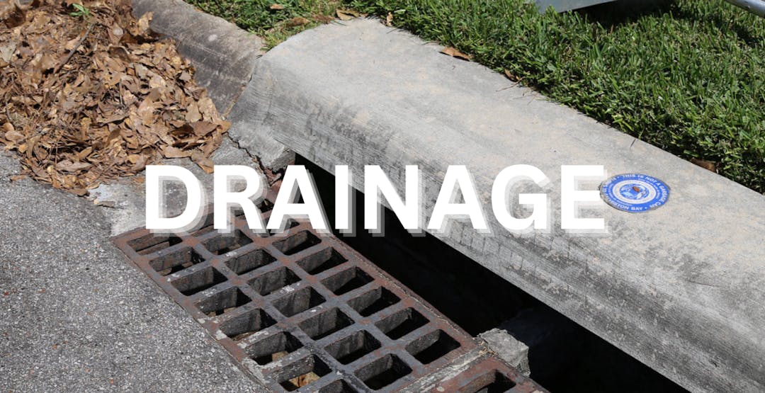
2. Improves Drainage Infrastructure
Upgrading the storm drainage system enhances the area’s ability to manage stormwater, reducing long-standing drainage issues and minimizing disruptions during storms.
3. Rebuilds Critical Roadways
The project includes the reconstruction of roads, making them safer and more reliable for everyday use while also improving long-term durability.
4. Upgrades Water and Wastewater Lines
Replacing and enhancing water and wastewater infrastructure ensures more reliable utility service for residents and reduces the risk of service interruptions or leaks.
5. Supports Community Resilience
By addressing multiple infrastructure needs at once—drainage, roads, and utilities—this project strengthens the neighborhood’s ability to recover quickly from severe weather events.
