
Bissonnet Corridor Safe Streets Project
LOCATION Bissonnet Street from South Dairy Ashford Road to Hillcroft Avenue (see Project map)
TYPE Plan (study)
START Winter 2024
COMPLETION Summer 2024
DETAILS The City of Houston was awarded $28.79 million in federal funding in 2023 through the Safe Streets and Roads for All (SS4A) program, which supports the goal of zero deaths and serious injuries on our nation’s roadways. The funding will support the Bissonnet Corridor Safe Streets Project, a seven-mile rehabilitation of Bissonnet Street from South Dairy Ashford Road to Hillcroft Avenue. Bissonnet Street is currently one of the most dangerous corridors across Houston – it is on the High Injury Network and accounts for the highest number of fatal crashes and the second-highest number of serious injury crashes across all City-owned streets. The Project’s goal is to improve safety for all street users in line with the City of Houston’s Vision Zero mission.
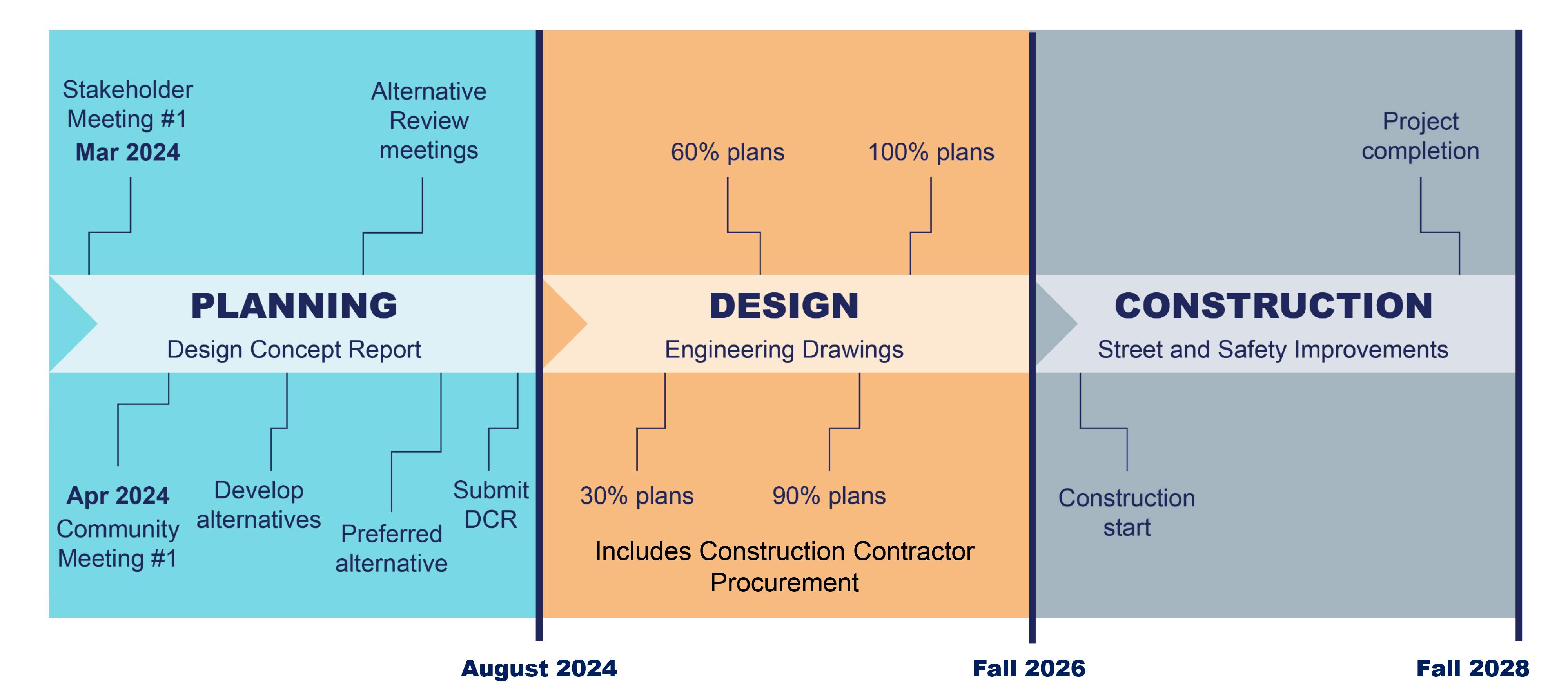
The Project is currently in the initial phase of the Design Concept Report (DCR). During this preliminary planning phase, the City will work with consultants and the community on:
- Collecting data to understand existing conditions along the corridor
- Engaging community members and local stakeholders to understand key issues and opportunities along the corridor
- Developing several design alternatives for improving safety conditions
- Recommending a preferred design alternative and presenting it to the community
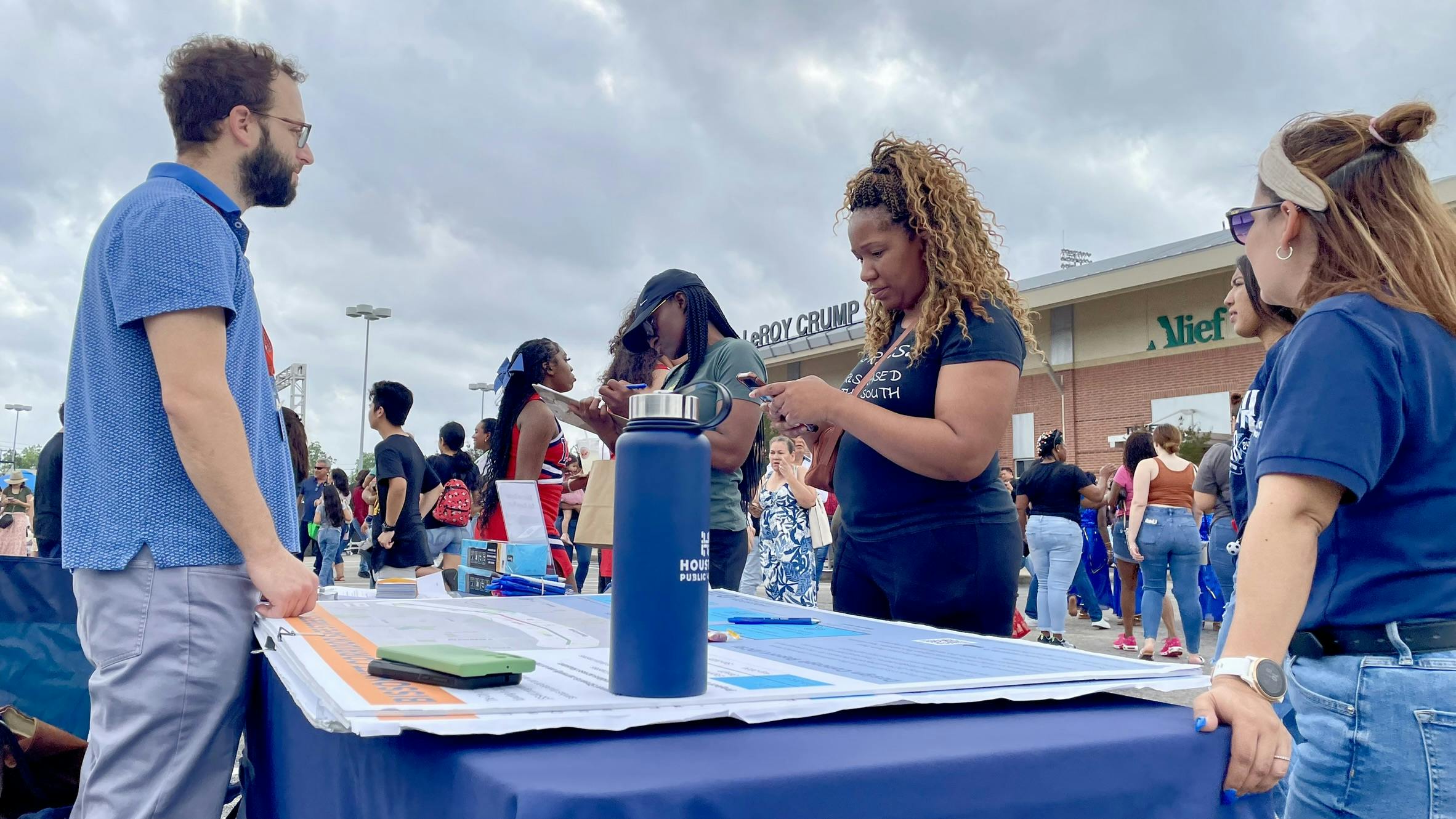
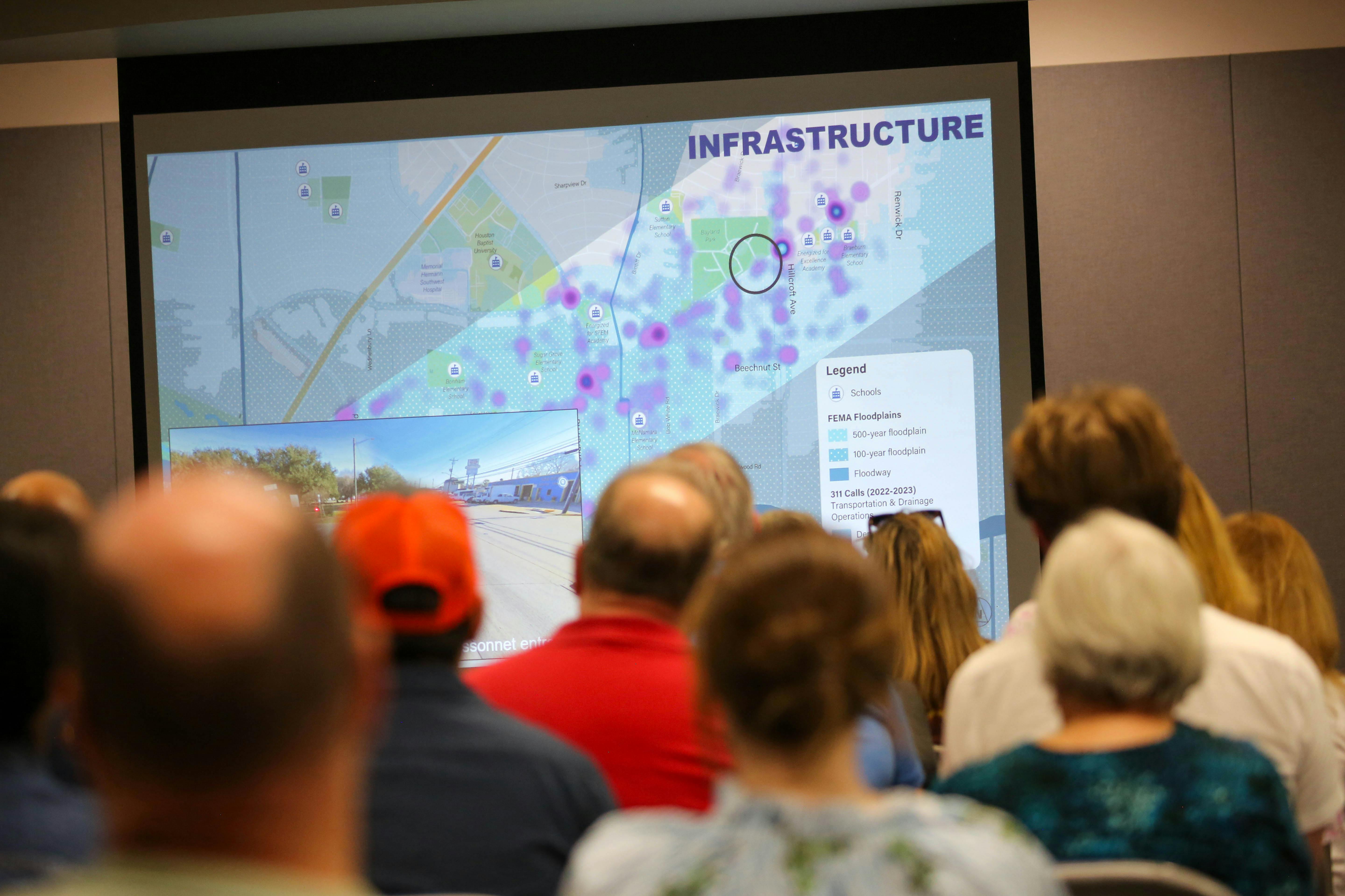
The resulting DCR report will become the basis for the second phase of the Project– the development of engineering design plans. Once engineering plans are reviewed and approved, the final construction phase will begin. Community members will have several opportunities to participate in the DCR process and provide feedback that will inform the design alternatives. Details regarding the date and location of these public meetings will be added to this webpage once confirmed.
MAP

General Project Information
What is the purpose of this project? | |
What is the timeframe of this process? |
Project Phases

Community Meeting

Overall Project Timeline
Taste of Alief, April 27, 2024
Community Meeting 1, April 4, 2024

Resources
-
 CITY OF HOUSTON AWARDED FEDERAL SAFE STREETS AND ROADS FOR ALL (SS4A) GRANT FOR BISSONNET CORRIDOR PROJECT
-
Safe Streets and Roads for All (SS4A) Grant Program
-
Bissonnet Safe Streets and Roads for All Application-NARRATIVE (2.7 MB) (pdf)
-
TxDOT’s Crash Record Information System
-
Frequently Asked Questions (139 KB) (pdf)
Who's Listening
-
Outreach Coordinator, Transportation & Drainage Operations

Email engage@houstontx.gov -
Planner Manager, Transportation & Drainage Operations

Email engage@houstontx.gov -
Planner IV, Planning Department

Email engage@houstontx.gov